
Bercianos del Real Camino
❯ Mansilla de las Mulas
26,7km
STAGE DISTANCE
Information
The stage between Bercianos del Real Camino and Mansilla de las Mulas has an approximate distance of 26.3 km, an average duration close to 6 hours, and a practically flat profile. You will not encounter great difficulties in terms of elevation, but you will have to face several long and straight sections between localities, so it is important that you leave with sufficient water and some food, especially during summer months.
The route continues crossing the Leonese Plateau, among vast cereal extensions and paths that seem to extend to the horizon. Almost the entire day runs via dirt tracks built specifically for pilgrims, parallel to small roads and accompanied in many sections by a row of trees. Although they offer some shade, the landscape remains very open and can be monotonous during the central hours of the day.
The first part of the stage leads to El Burgo Ranero, situated about 7.4 km from Bercianos. From this village begins the longest section of the day, with approximately thirteen kilometers to Reliegos. From there only about six kilometers remain to reach Mansilla de las Mulas, where the Way enters a walled medieval village situated beside the Esla River.
Mansilla de las Mulas is one of the most interesting stage endings before arriving in León. Its walled enclosure, the Castle Gate, the Church of Santa María, and the ancient convent of San Agustín reflect the importance the locality had as a defensive point and as a place of passage and hospitality for pilgrims.
Recommendation from The Way
Recommendation in stage 19: Bercianos del Real Camino – Mansilla de las Mulas
Although the profile is simple, you should not become overconfident solely due to the absence of elevation changes. Between El Burgo Ranero and Reliegos you will travel approximately thirteen kilometers without passing through any village, so it is recommended that you take advantage of the previous stop to refill water and carry some food. Outside of season it is also wise to check in advance which establishments remain open.
Heat and sun exposure are again the main conditioning factors of the day. The trees planted beside the path provide some shade, but they do not always form a continuous protected area. During summer it is preferable to leave early and avoid completing the longest stretch during the central hours of the day.
After several days of rain, loose stones, puddles, and muddy areas can appear on the dirt roads. If you do the Way by bicycle, the flat terrain allows easy progress, but you should moderate speed at underpasses, crossings, and points where the path is shared with other pilgrims.
People with reduced mobility will find a generally comfortable route, although there are small elevation changes, areas of irregular surface, and several passages under roads and railway tracks. The entrance to Mansilla de las Mulas does not present major difficulty either, but it is wise to advance with caution at the elevated passage over the N-601 and at the crossing of the Porma Canal.
Stage profile
A long and practically flat stage that crosses the Leonese Plateau via dirt tracks parallel to local roads. The route passes through El Burgo Ranero and Reliegos before entering Mansilla de las Mulas via the historic Castle Gate. The main difficulty is found in the distance, sun exposure, and the thirteen kilometers without villages between El Burgo Ranero and Reliegos.
Itinerary
· Bercianos del Real Camino
The stage begins in Bercianos del Real Camino, a small locality of medieval origin whose name recalls the repopulation of these lands by inhabitants from the Bierzo region. The Way crosses the village via Calle Mayor and continues toward the outskirts, where the pedestrian path used during the previous stage reappears.
Before leaving you can approach the Hermitage of Our Lady of Perales, known as La Perala, or view the parish Church of El Salvador, two of the main heritage elements of the locality. Bercianos also maintains a strong tradition of welcoming travelers on the French Way.
At the end of Calle Mayor you will begin walking via a dirt track accompanied by a row of trees and situated beside a local road. The A-231 highway initially remains to your right, while the route advances among cereal fields and with a practically clear horizon.
· Initial Section · Path to El Burgo Ranero
The first kilometers are comfortable and allow maintaining a constant pace. The path advances practically in a straight line and is only interrupted by some crossings and rest areas.
About 5.7 km from Bercianos, the Way crosses the A-231 highway via an underpass. Just after it also crosses beneath the high-speed railway lines and continues for just under two kilometers until reaching El Burgo Ranero.
· El Burgo Ranero
El Burgo Ranero is the first village of the day and one of the villages most clearly organized around the Jacobean route. Its village develops following the ancient pilgrim towpath, which currently corresponds with Calle Real.
The main monument of the village is the parish Church of San Pedro. The hermitage of the Holy Christ of the True Cross is also found here. The traditional adobe and brick architecture and the elongated disposition of the nucleus reflect the rural and pilgrim character of this part of the Leonese Plateau.
El Burgo Ranero is a good point to rest and provision yourself before beginning the longest section of the day. From its exit you will have to travel approximately thirteen kilometers to Reliegos, without passing through any other village situated directly on the main route.
· Intermediate Section · From El Burgo Ranero to Reliegos
The Way crosses El Burgo Ranero via Calle Real and recovers at the exit the same tree-lined path. From here begins a long straight stretch parallel to the LE-6615 road, with cereal fields on both sides and small rest areas distributed along the route.
This is one of the most solitary and repetitive sections of the stage. The elevation is practically non-existent, but the distance and lack of changes in the landscape can make the day progress more slowly than expected. It is important to maintain a regular pace and not spend too much energy during the first kilometers.
The route passes near Villamarco, although the village is separated from the main route. The official Way guide in Castile and León places in this nucleus the Church of the Immaculate and the hermitage of Christ the Protector, but it is not necessary to enter the village to continue toward Reliegos.
A few kilometers before reaching Reliegos, the Way crosses beneath the railway lines via an underpass. The path continues afterward practically straight until the first buildings of the locality begin to appear.
· Reliegos
Reliegos is the second village of the day and appears after the long stretch from El Burgo Ranero. Its village preserves examples of popular Leonese architecture built with adobe and develops around the route of the French Way.
The locality is situated in territory where several Roman roads converged, which demonstrates that this environment was used as a place of passage long before the development of the Way of Santiago. Its main monument is the parish church of San Cornelio and San Cipriano, which preserves a Gothic carving from the old depopulated settlement of Escarbayosa.
Reliegos is the last point where you can stop before reaching Mansilla de las Mulas. From here approximately 5.9 km remain, again via a comfortable and practically flat path.
· Final Section · From Reliegos to Mansilla de las Mulas
At the exit from Reliegos you will again take the pedestrian path parallel to the LE-6615 road. Shortly after you will begin to see Mansilla de las Mulas on the horizon, although you will still have to overcome several crossings before reaching the urban nucleus.
About 1.5 km from Reliegos, the Way passes beneath a viaduct of the A-60 highway. The route continues afterward via the same path until reaching the N-601 road, which is crossed via an elevated passage. Shortly after the Porma Canal is crossed and the final approach to Mansilla begins.
Entry is made following Avenida de la Constitución until reaching the Castle Gate, situated in the southeast sector of the ancient walled enclosure. Of the original gate, its lateral walls remain, while the arch that united them has disappeared. Beside this access is the pilgrim monument, which recalls Mansilla’s condition as a meeting point between the French Way and the ancient Roman road.
· Mansilla de las Mulas
The stage ends in Mansilla de las Mulas, a medieval village situated beside the Esla River. The locality was fortified during the reign of Ferdinand II of León, who granted it a charter in 1181, and preserves important sections of its ancient walled enclosure.
Once inside the historic nucleus, the Way passes beside the Church of Santa María and continues toward Plaza del Pozo, where it joins with the variant coming from the Via Trajana and Calzadilla de los Hermanillos. You can also approach the ancient convent of San Agustín, current headquarters of the Provincial Ethnographic Museum of León.
Mansilla has adequate lodging, dining, and services to end the day. Its proximity to the Esla River, the medieval layout of its streets, and its walled heritage make it one of the most complete stage endings before entering León.
What to See
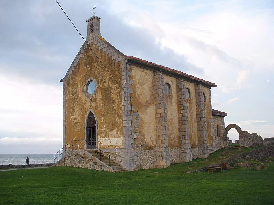
Hermitage of Our Lady of Perales, in Bercianos del Real Camino
The Hermitage of Our Lady of Perales, known as La Perala, is one of the main monuments of Bercianos del Real Camino. The building is constructed in brick and maintains a simple structure, presided over by a bellgable.
The hermitage maintains great importance for the residents of the locality, who celebrate each September 8 a pilgrimage in honor of the Virgin.
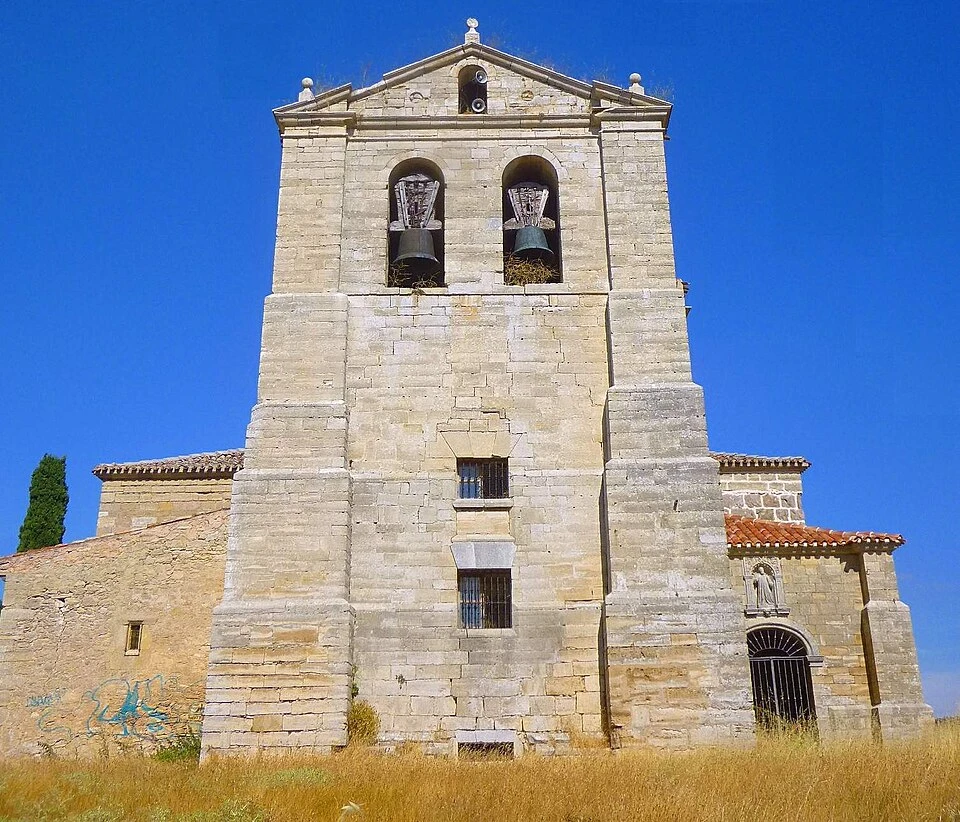
Parish Church of El Salvador, in Bercianos del Real Camino
The parish Church of El Salvador is part of Bercianos’s religious heritage. The official French Way guide dates it to the seventeenth century and includes it along with the Hermitage of Our Lady of Perales and the Hermitage of San Roque among the main historic elements of the village.
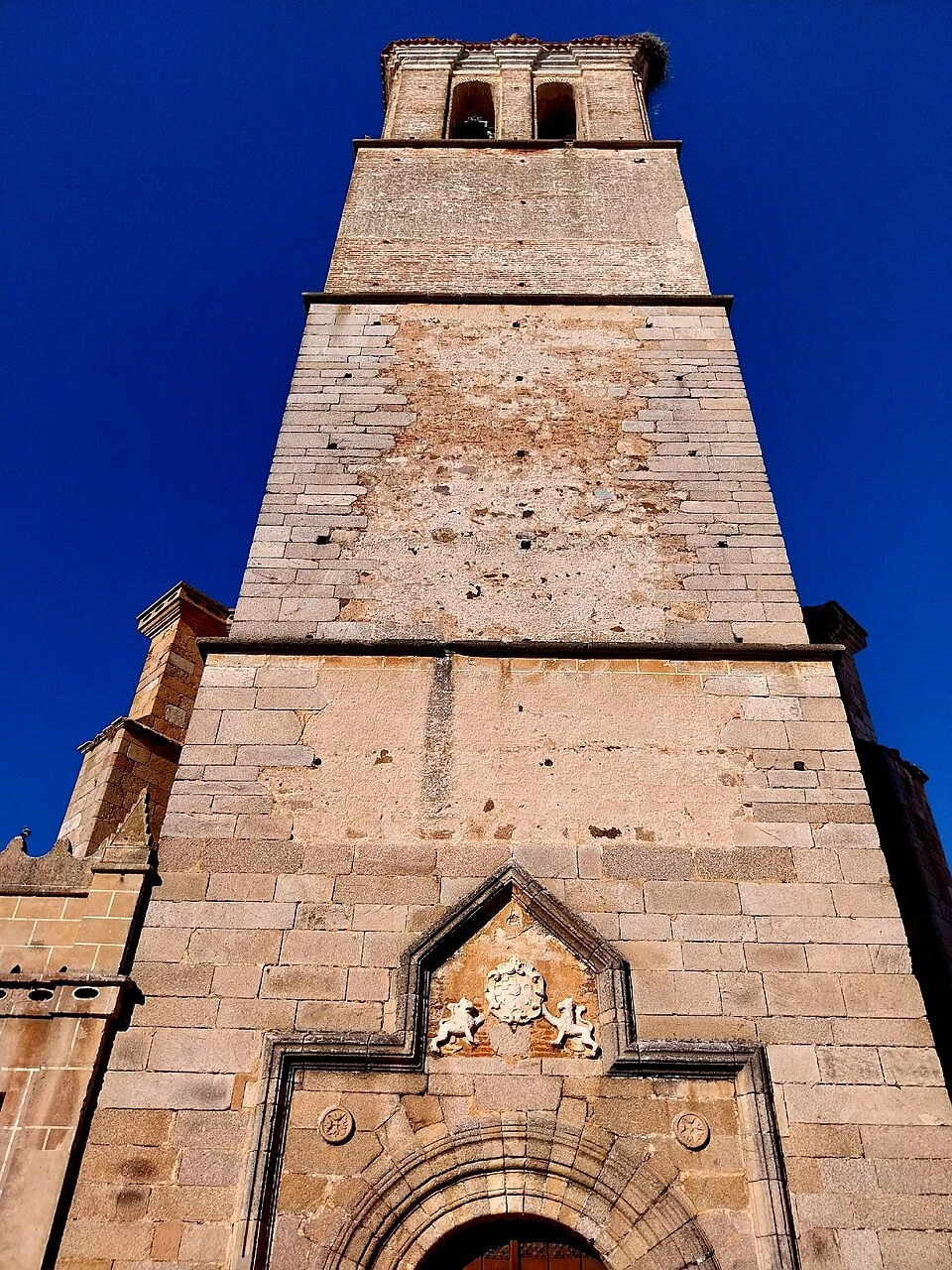
Church of San Pedro, in El Burgo Ranero
The parish Church of San Pedro is the main monument of El Burgo Ranero. It is integrated within a village arranged around the ancient pilgrim towpath and represents the main reference point of the urban nucleus.
El Burgo Ranero also preserves the Hermitage of the Holy Christ of the True Cross, another of the religious elements linked to the history of the locality.
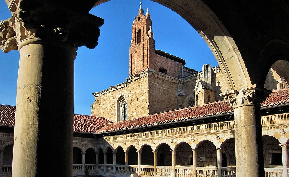
Traditional Architecture of El Burgo Ranero
The village preserves traditional adobe and brick constructions characteristic of the Leonese Plateau. Its elongated structure organized around Calle Real allows you to understand how the constant passage of pilgrims conditioned the development of numerous localities on the French Way.
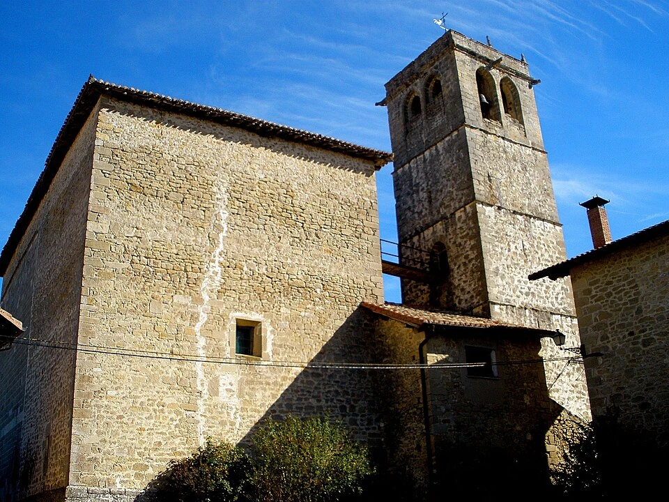
Church of San Cornelio and San Cipriano, in Reliegos
The parish Church of San Cornelio and San Cipriano is the main monument of Reliegos. In its interior it preserves a Gothic carving from the disappeared settlement of Escarbayosa.
The visit allows you to complete the passage through a locality where popular adobe architecture and Jacobean tradition continue to have a very visible presence.
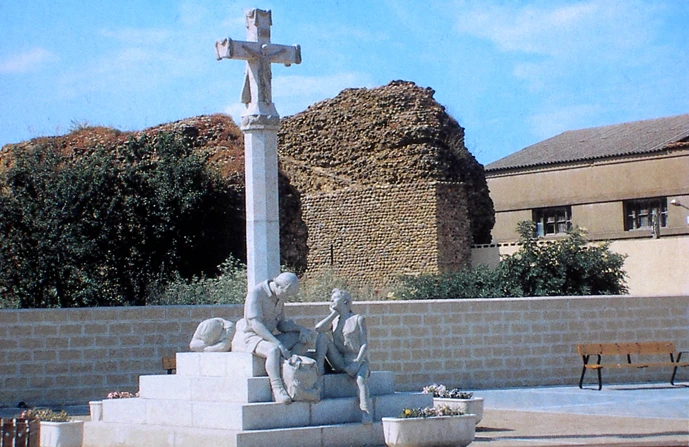
Castle Gate and Pilgrim Monument
The Castle Gate is the traditional access of the French Way to the interior of Mansilla de las Mulas. It is situated in the southeast sector of the walled enclosure and preserves its two lateral walls, although the arch that united them has disappeared.
Beside it is the pilgrim monument, placed at this point due to the confluence of the French Way with the route coming from the ancient Roman road.
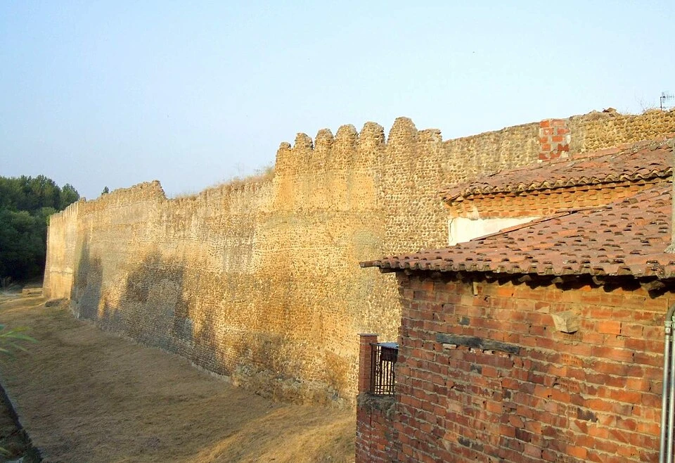
Walls of Mansilla de las Mulas
The walled enclosure is one of Mansilla’s most important elements. It was constructed with river stones and lime and preserves several sections, defensive towers, and some of the ancient access gates.
The Gate of the Conception or of Santa María is the one that remains in the best condition. It features a pointed arch of cut stone and served as an entrance for those arriving from the Via Trajana variant.
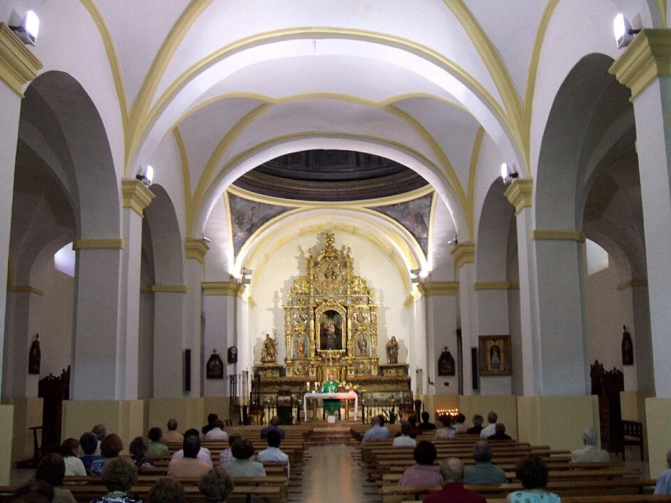
Church of Santa María
The Church of Santa María is the main temple of Mansilla de las Mulas. The current building was constructed in the eighteenth century over an earlier church and features a basilical floor plan of three naves, a crossing, and a dome over pendentives.
The Baroque altarpiece of the main altar stands out in its interior, also from the eighteenth century, composed of different reliefs and religious images. The ensemble was restored in 2002.
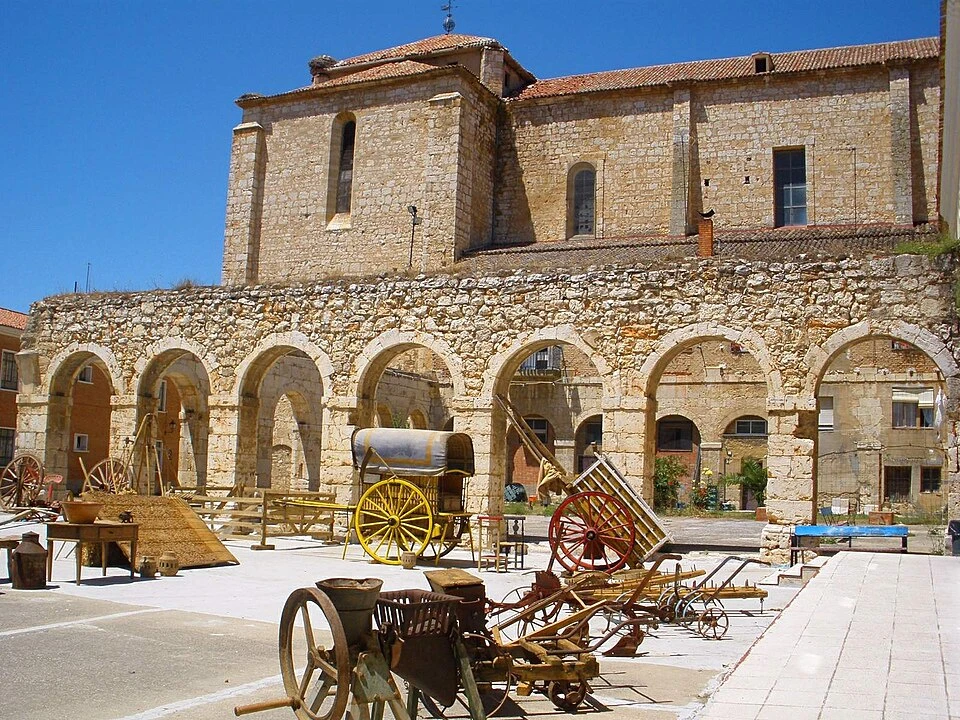
Ancient Convent of San Agustín and Ethnographic Museum
The Convent of San Agustín was founded in the late fifteenth century and came to function as an important cultural center, with chairs of Grammar and Latin, an archive, and library. Much of the ensemble disappeared after the French invasion and the nineteenth-century disamortization.
It currently houses the Provincial Ethnographic Museum of León, whose collection gathers thousands of pieces related to traditional culture, trades, and daily life in the province.
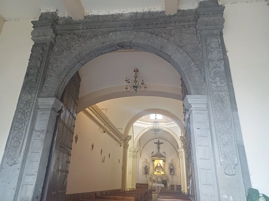
Sanctuary of the Virgin of Grace
The Sanctuary of the Virgin of Grace is located outside the walled enclosure and is dedicated to Mansilla’s patroness. The current building mainly reflects the reconstructions carried out in the late nineteenth century after a fire destroyed the sanctuary and its ancient image.
The image currently preserved was restored by sculptor Víctor de los Ríos in the mid-twentieth century and continues to be the object of important local devotion.
Localities
Bercianos del Real Camino
Bercianos del Real Camino is a small locality that emerged during medieval repopulation with inhabitants from the Bierzo region. Its layout, traditional constructions, and name maintain a close relationship with the agricultural and Jacobean history of the Leonese Plateau.
Among its main heritage elements are the Hermitage of Our Lady of Perales, the parish Church of El Salvador, and the Hermitage of San Roque.
El Burgo Ranero
El Burgo Ranero is a locality organized around the ancient pilgrim towpath, which crosses the nucleus via Calle Real. Its elongated form and traditional constructions show the influence the Way had on the village’s development.
Its main monuments are the parish Church of San Pedro and the Hermitage of the Holy Christ of the True Cross. It is also the last inhabited nucleus before the long thirteen-kilometer stretch to Reliegos.
Reliegos
Reliegos belongs to the municipality of Santas Martas and is located in an environment where several Roman-era roads converged. Its village preserves different examples of traditional Leonese architecture built with adobe.
The main monument of the locality is the parish church of San Cornelio and San Cipriano. From Reliegos approximately five kilometers remain to reach Mansilla de las Mulas.
Mansilla de las Mulas
Mansilla de las Mulas is an ancient walled village situated beside the Esla River. It was fortified during the Middle Ages and became a strategic point of the Way due to the confluence of the French route with the ancient Via Trajana.
The locality preserves important remains of its walls, the Castle Gate, the Gate of the Conception, the Church of Santa María, the ancient Convent of San Agustín, and the Sanctuary of the Virgin of Grace. Its heritage and services make it one of the most complete stage endings before arriving at the city of León.
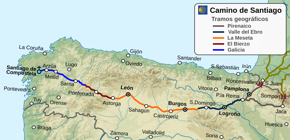
Route map
Ready to begin your journey?