
Carrión de los Condes
❯ Terradillos de los Templarios
26,2km
STAGE DISTANCE
Information
The stage between Carrión de los Condes and Terradillos de los Templarios does not present great difficulties in terms of elevation, but it does require some planning due to its length and the absence of services during much of the route. From the departure from Carrión de los Condes to Calzadilla de la Cueza you will travel more than seventeen kilometers without passing through any village, so it is important that you carry sufficient water and some food, especially during the summer months.
The landscape continues to be dominated by the vast cereal extensions of Tierra de Campos. The long, straight, and practically flat tracks can make some stretches monotonous, especially due to the lack of shade and nearby landmarks. In exchange, you will walk for several kilometers along the route of the Vía Aquitania, an ancient Roman road that connected Bordeaux with Astorga and that later became part of the route used by pilgrims heading to Santiago.
After the long initial stretch, the Way passes through Calzadilla de la Cueza and Ledigos before reaching Terradillos de los Templarios. The stage ends in a small locality closely linked to the Order of the Temple and to one of the best-known legends of this part of the Way: the story of the hen with the golden eggs, which tradition places hidden in the surroundings of the village.
Recommendation from The Way
Recommendation in stage 17: Carrión de los Condes – Terradillos de los Templarios
The main difficulty of this stage is the long section without services between Carrión de los Condes and Calzadilla de la Cueza. For more than seventeen kilometers you will not find villages, fountains, or establishments where you can buy food or refill your water bottle. At certain times of the year a mobile vendor may set up near the Benevívere area, but this is a temporary service that you should not count on when planning your day.
For this reason, it is recommended that you leave Carrión with sufficient water and something to eat. This precaution is especially important during summer, when heat and lack of shade can make a simple route in terms of elevation more demanding than expected. Whenever possible, it is best to start early to avoid the central hours of the day.
You should also pay attention at crossings of the N-120 and in sections that run near the road, as traffic is usually constant. If you do the Way by bicycle, the absence of large elevation changes facilitates the journey, although mud and loose stones can complicate some tracks after several days of rain.
Stage profile
A long but practically flat stage, marked by the extensive section without villages that separates Carrión de los Condes from Calzadilla de la Cueza. The route advances for several kilometers via the ancient Vía Aquitania, among vast cereal fields and with very few shaded areas. After Calzadilla, the Way passes through Ledigos and continues beside the N-120 to Terradillos de los Templarios.
Itinerary
· Carrión de los Condes
The stage begins in Carrión de los Condes, one of the localities with the greatest historical and Jacobean importance in Tierra de Campos. From the center, the Way passes in front of the Church of Santiago and heads toward the stone bridge over the Carrión River.
Right after crossing the river you will leave to one side the Royal Monastery of San Zoilo, one of the main monumental ensembles of the locality. The monastery was very much linked to the sheltering of pilgrims and preserves a notable plateresque cloister, in addition to different elements related to the medieval history of Carrión de los Condes.
After the monastery, the route reaches a roundabout, crosses the N-120, and continues via a local road in the direction of Villotilla. For just over three kilometers you will advance via asphalt before abandoning the road and entering the vast tracks of Tierra de Campos.
· Surroundings of the Ancient Abbey of Benevívere
The Way passes near the site of the ancient abbey of Santa María de Benevívere, founded in the twelfth century. Although few visible remains of the ensemble are currently preserved, the place recalls the importance that religious communities and assistance centers had during the development of the Way of Santiago.
Shortly after, the route abandons the road and continues via a wide dirt track. From this point begins the longest and most characteristic section of the stage, following for several kilometers the route of the ancient Vía Aquitania.
· Intermediate Section · Vía Aquitania
The Vía Aquitania advances in a straight line among vast cereal fields. The terrain is comfortable and practically flat, but the lack of shade, services, and villages means the section can feel long, especially on hot days.
During the route you will barely find nearby visual references. The straight stretches seem to extend to the horizon and the landscape changes very little, so it is important to maintain a constant pace and manage your water well from the beginning.
Calzadilla de la Cueza is located in a small depression of the terrain and remains hidden during almost the entire route. You will not be able to see it from a distance, but rather it will appear practically when you are entering the locality. This characteristic can make the final kilometers of the section seem longer than they really are.
· Calzadilla de la Cueza
Calzadilla de la Cueza is the first village of the stage and the first place where you can stop after the long stretch from Carrión de los Condes. Its situation within a small hollow explains why the village is not visible until the last meters.
In the locality stands out the Church of San Martín de Tours, a temple of medieval origin that has undergone numerous reforms over the centuries. In its interior it preserves a Renaissance altarpiece from the sixteenth century and different elements related to the Order of Santiago.
At the exit from the village you must cross the N-120 and continue via a track parallel to the road. At this point it is important to pay attention to traffic and follow the Way’s indications correctly.
· Ancient Hospital of Santa María de las Tiendas
Shortly after leaving Calzadilla de la Cueza, the Way passes near the site of the ancient hospital-monastery of Santa María de las Tiendas, also known as the Hospital of the Great Knight.
This establishment was linked to the Order of Santiago and provided assistance to pilgrims during the Middle Ages. Although few visible remains are currently preserved, its presence recalls the network of hospitals and assistance centers that formerly accompanied walkers.
Further on you will find a bifurcation with two options that end up linking in Ledigos. The main route continues beside the road, while the other alternative advances via a dirt track and enters the village from its upper part.
· Ledigos
Ledigos appears on a gentle elevation of terrain, with the Church of Santiago situated in the upper part of the village. The temple has medieval origins, although it was reformed during the seventeenth century, and maintains a close relationship with the Way of Santiago.
In its interior various representations of the Apostle are preserved: as a pilgrim, as an apostle, and as Santiago Matamoros. The historic existence of a hospital dedicated to San Lázaro also confirms the importance the locality had as a place of passage and assistance.
From Ledigos there remain approximately three kilometers to reach Terradillos de los Templarios. At the exit from the village you will again cross the N-120 and continue via a pedestrian track parallel to the road. Shortly after, the Way crosses the Cueza River and heads toward the end of the stage.
· Terradillos de los Templarios
The entrance into Terradillos de los Templarios is made via a detour from the main track that leads to the small urban nucleus. The locality is located in a tranquil setting, surrounded by the agricultural fields characteristic of Tierra de Campos.
Its name recalls the historic relationship of the place with the Order of the Temple. Local tradition tells that in the surroundings of the village the hen with the golden eggs was buried to prevent it from being taken to Santiago de Compostela. Although it is a legend, it continues to be one of the best-known elements of Terradillos’s identity.
What to See
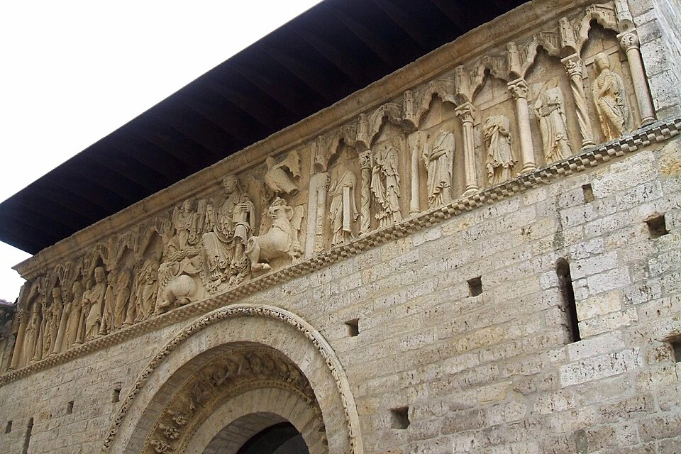
Church of Santiago, in Carrión de los Condes
The Church of Santiago is one of the main Romanesque monuments of Carrión de los Condes. Its most outstanding element is the western facade, presided over by a representation of Christ in Majesty accompanied by the symbols of the evangelists and the figures of the twelve apostles.
The Way passes in front of the temple during the departure from the locality, so you can visit it before beginning the stage.
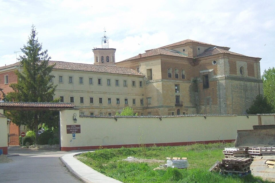
Royal Monastery of San Zoilo
The Royal Monastery of San Zoilo is located beside the bridge over the Carrión River. It was one of the main religious and assistance centers of the Way in this part of Castile and was linked for centuries to the sheltering of pilgrims.
The ensemble preserves a notable plateresque cloister and different elements related to the medieval nobility of Carrión de los Condes.
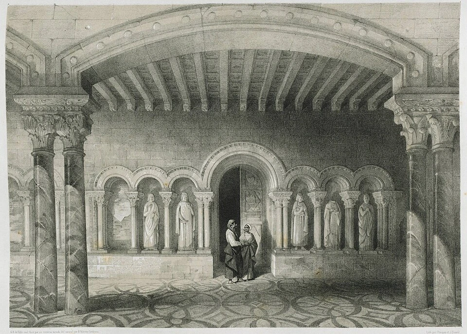
Remains of the Abbey of Benevívere
The Abbey of Santa María de Benevívere was founded in 1161 by Diego Martínez de Villamayor. After his death, his brother Rodrigo took charge of continuing work that lasted until the beginning of the thirteenth century.
The abbey came to have several priories and had an important religious presence in the area. Currently few visible remains of the ancient ensemble are left, but its location is part of the history of this stage.
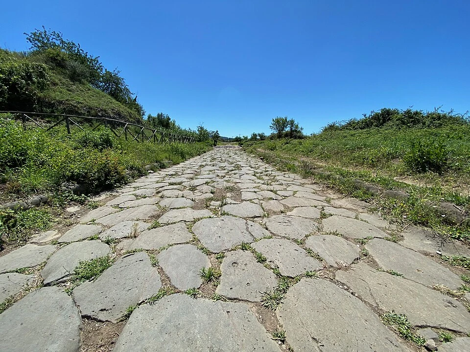
Vía Aquitania
The Vía Aquitania is one of the most important elements of the route. This ancient Roman road connected Bordeaux with Astorga and was later used as a passage route by pilgrims heading to Santiago de Compostela.
During this stage you will walk several kilometers along its route, among vast cereal fields and long practically straight tracks.
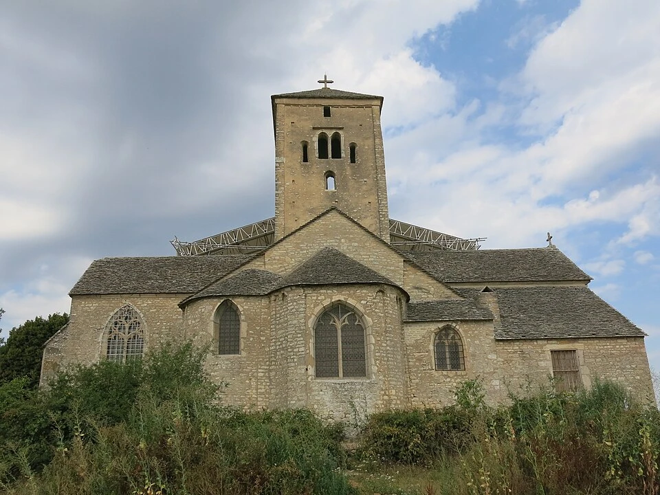
Church of San Martín de Tours, in Calzadilla de la Cueza
The Church of San Martín de Tours was built in the Middle Ages, although the numerous reforms made later have modified much of its original appearance.
In its interior a Renaissance altarpiece from the sixteenth century stands out, along with different elements linked to the Order of Santiago.
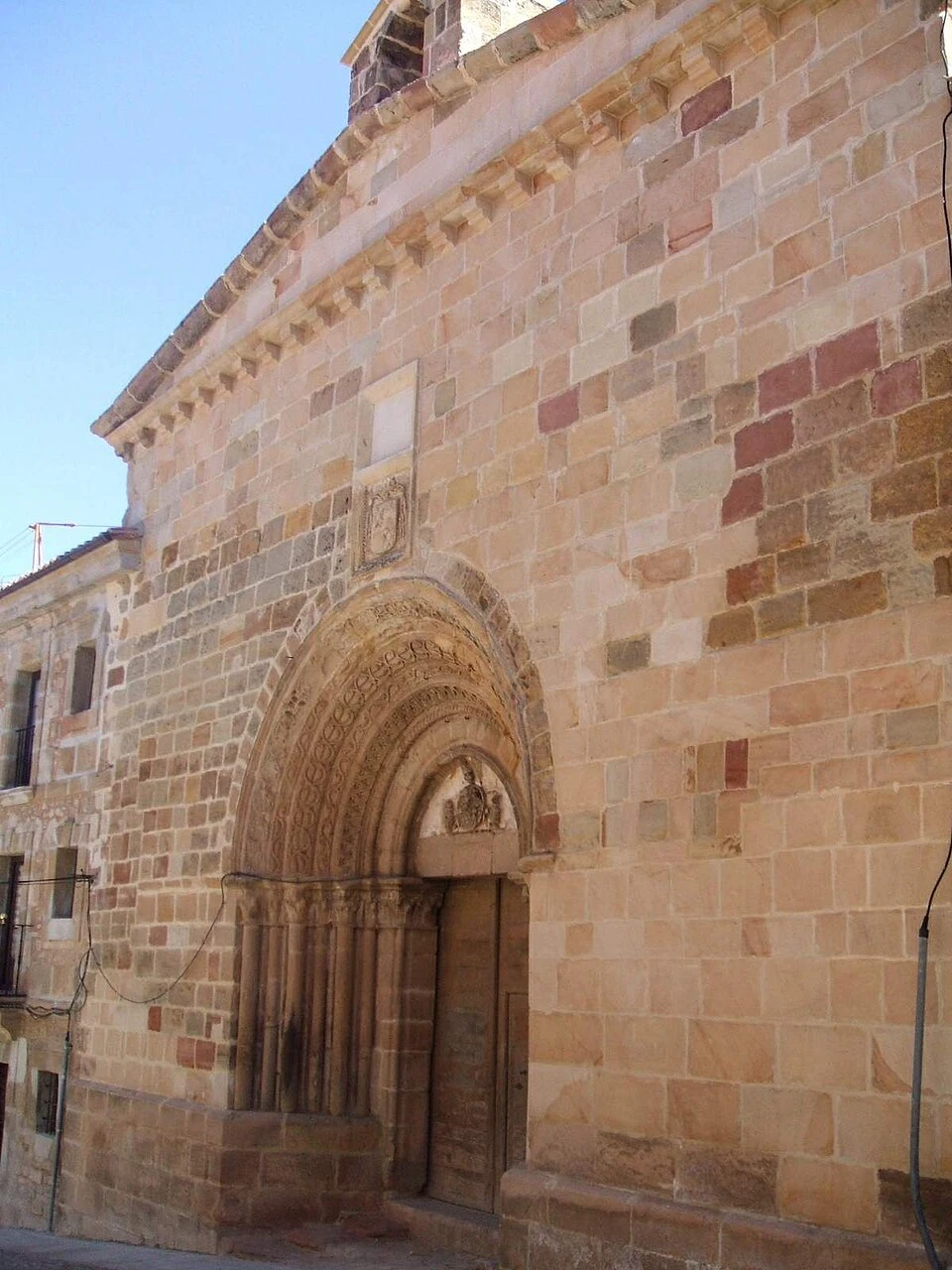
Church of Santiago, in Ledigos
The Church of Santiago is located in the upper part of Ledigos, from where you can obtain broad views of the village and the fields surrounding it.
The temple was reformed around the seventeenth century and preserves three different representations of the Apostle Santiago: dressed as a pilgrim, as an apostle, and as Santiago Matamoros.
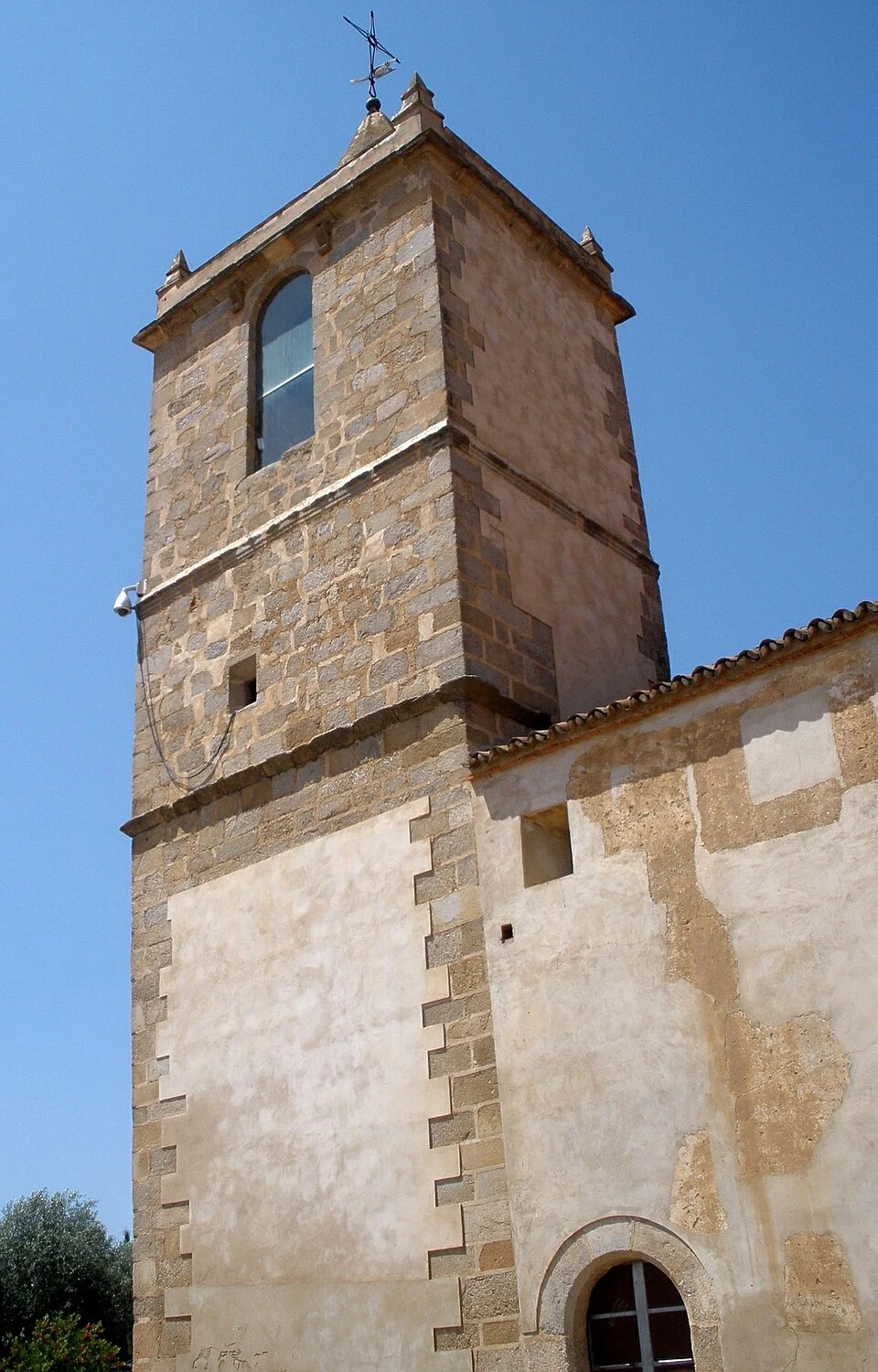
Church of San Pedro, in Terradillos de los Templarios
The Church of San Pedro is the main monument of Terradillos de los Templarios. It features a simple structure of a single nave and a round arch that provides access to the presbytery.
In its interior it preserves a main altarpiece from the seventeenth century and a Gothic crucifix from the fourteenth century.
Localities
Carrión de los Condes
Carrión de los Condes is one of the most important localities of the French Way in Tierra de Campos. Its historical and Jacobean past is reflected in heritage comprising churches, monasteries, and ancient assistance centers.
Among its main monuments are the Church of Santiago, the Church of Santa María del Camino, the Royal Monastery of San Zoilo, and the Monastery of Santa Clara. The locality also has all necessary services before beginning the long stretch to Calzadilla de la Cueza.
Calzadilla de la Cueza
Calzadilla de la Cueza is a small locality situated in a depression of the terrain, so it remains hidden until the final meters of the route.
Its position at the end of the longest village-less section of this stage makes it a particularly important stop for resting, eating, and refilling water. Its main monument is the Church of San Martín de Tours.
Ledigos
Ledigos is a small locality with Jacobean tradition situated on a gentle elevation of terrain. Its main monument is the Church of Santiago, located in the upper part of the village.
The historic existence of a hospital dedicated to San Lázaro demonstrates the hospitality function the locality had within the French Way.
Terradillos de los Templarios
Terradillos de los Templarios is a small locality belonging to the municipality of Lagartos. Its name and history are related to the presence of the Order of the Temple in this area of the Way.
The Church of San Pedro is its main monument, while the legend of the hen with the golden eggs constitutes one of the best-known stories linked to the village.
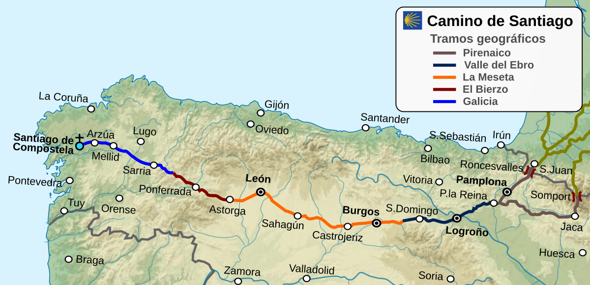
Route map
Ready to begin your journey?