Home Camino de Santiago Camino Francés Stage 1 of the French Way: Saint-Jean-Pied-de-Port

Saint-Jean-Pied-de-Port
Roncesvalles

24.2km

STAGE DISTANCE

Stage 2 ›

Roncesvalles ❯ Zubiri

Pilgrim traffic
Difficulty
Art / History
Nature
Urban route
Stage 1 · French way

Information

About this stage

The stage between Saint-Jean-Pied-de-Port and Roncesvalles is one of the most iconic, demanding, and memorable of the entire French Way. For many pilgrims, it marks the true beginning of the adventure: a high mountain day that crosses the Pyrenees from the French town of Saint-Jean-Pied-de-Port to the historic collegiate church of Roncesvalles, now in Navarre. The best-known route is the Route of Napoleon, a spectacular route that climbs from the 172 meters altitude of Saint-Jean-Pied-de-Port to the 1,430 meters of the Lepoeder pass, before beginning the descent to Roncesvalles, situated at 945 meters. On the classic route, over 1,200 meters of cumulative elevation gain is exceeded, which explains why this day is considered one of the hardest on the French Way, but also one of the most beautiful.

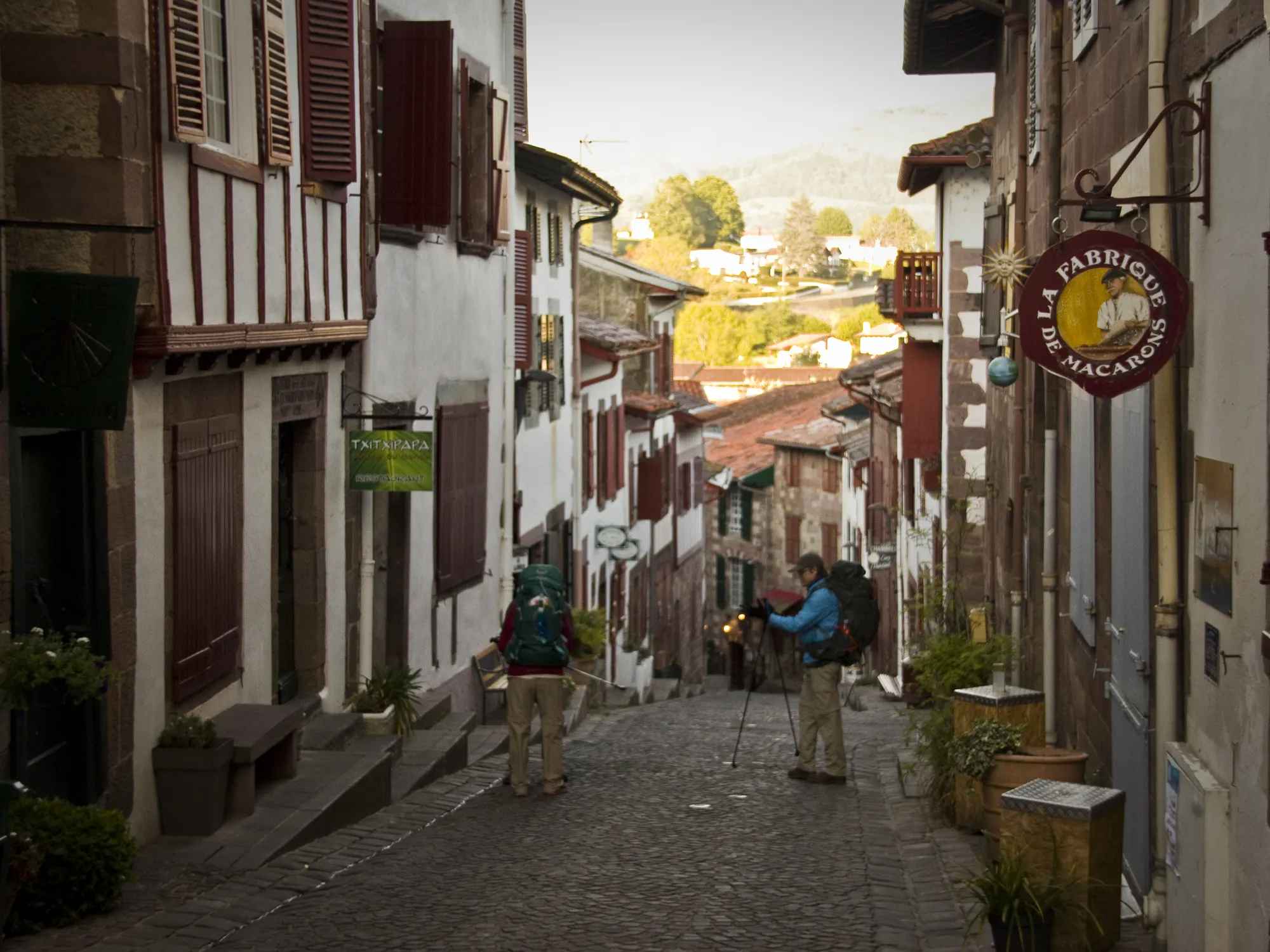
Saint-Jean-Pied-de-Port is no ordinary place. This fortified town in the French Basque Country, crossed by the Nive River and famous for its white facades and red-tiled roofs, has been for centuries one of the great starting points towards Compostela. Its Porte Saint-Jacques, the historic pilgrim entrance, is recognized as part of the heritage linked to the Routes of Santiago. From there, the walker leaves the medieval town center and heads toward a stage where the landscape changes rapidly: first meadows and hills, then grand mountain panoramas, passes, high pastures, and finally a leafy descent through beech forests to Roncesvalles.

Roncesvalles, the destination of the day, is one of the great symbols of the Way of Santiago. In addition to being one of the historic gateways to the peninsula, it preserves a monumental ensemble of enormous value, presided over by the Royal Collegiate Church of Santa María, the Church of Santiago, and the Silo of Charlemagne, all deeply linked to Jacobean tradition and the legendary memory of the Battle of Roncesvalles.

Recommendation from The Way

Recommendation for Stage 1: Saint-Jean-Pied-de-Port – Roncesvalles

This is not a stage to improvise on. If the pilgrim is not in good physical condition, suffers from knee or ankle discomfort, or simply prefers a less aggressive day, the most sensible option is to choose the Valcarlos variant, which runs at lower altitude and avoids the hardest part of the Pyrenean ascent. Additionally, the Route of Napoleon is closed from November 1 to March 31, so during that period the Valcarlos alternative is the mandatory option.

Weather should also be taken into account. On this stage, wind, fog, rain, or even snow can radically change the experience. In adverse conditions, a panoramic and extraordinary route can become a very hard and exposed day. That’s why, in addition to physical fitness, it’s important to start early, carry sufficient water, wear appropriate clothing, and check the weather before beginning the ascent.

For those doing the Way by bike, this stage also requires special caution. The gradient, terrain, and some descents require extreme care, and in certain sections it may be necessary to push the bike or choose the safer alternative.

Distance and elevation

Stage profile

The classic stage via the Route of Napoleon has an approximate distance of 24.2 km and an average duration close to 7 hours, although actual time depends greatly on pace, climate, and rest stops. Its main characteristic is the strong accumulated elevation gain: the ascent from Saint-Jean-Pied-de-Port to Lepoeder is long, constant, and very demanding, while the descent to Roncesvalles particularly strains the knees, especially if the terrain is wet or there is fog.

24,2 km

DISTANCIA

~7 h

DURACIÓN MEDIA

+1.200 m

DESNIVEL POSITIVO

1.430 m

ALTITUD MÁX. · LEPOEDER

050010001500St-Jean172 m · 0 kmHonto520 m · 5 kmOrisson790 m · 7,5 kmBentartea1340 m · 16,2 kmLepoeder1430 m · 20,2 kmIbañeta1100 m · 22 kmRoncesvalles945 m · 24,2 km
The profile of this stage makes it clear at first glance that we are facing a mountain day. The climb dominates much of the route until reaching the Lepoeder pass, while the final stretch descends steeply toward Roncesvalles. It’s a short stage on paper, but demanding in terms of sensation, so it should be interpreted more by its elevation gain than by its distance.
Step-by-step route

Itinerary

Km 0

· Saint-Jean-Pied-de-Port

The stage begins in one of the loveliest and most emblematic towns of the entire Way. Saint-Jean-Pied-de-Port preserves a historic town center with a medieval air, featuring cobblestone streets, walls, stone bridges, and an urban layout that still allows you to imagine the passage of ancient pilgrims. The traditional start passes through the Porte Saint-Jacques, the historic pilgrim entrance, and continues along Rue de la Citadelle and Rue d’Espagne, crossing the medieval bridge over the Nive River before leaving the town. In France, Way signage appears with GR-65 markings—red and white—although yellow arrows can also be seen.

Just outside the town center appears an important decision. A sign indicates the split between the Route of Napoleon, the classic and panoramic option, and the alternative Arnéguy / Valcarlos route, lower and safer in adverse weather. From this point the pilgrim leaves behind the comfort of the town and begins to understand the true dimension of the day.

Km 5
· Honto
The first kilometers are quite demanding. The climb begins early and requires finding a constant pace from the start. After overcoming the initial slopes, you reach the area of Honto—also cited as Huntto in some guides—a small mountain stop that many pilgrims use to catch their breath before facing the most serious part of the ascent. Here you can clearly perceive that we are on a different stage from the rest: less urban, more open, harder, and much more exposed.
Km 7,5
· Orisson

After Honto, the path continues to gain height among meadows and increasingly expansive panoramas. Orisson is one of the best-known points of the stage because it constitutes an important final reference before the high mountain section. The Orisson shelter and its surroundings are also one of the most photographed spots on this climb, precisely because of the views it offers over the undulating landscape of the French Basque Country. From here, the landscape becomes even more open and the pilgrim begins to walk fully through the great Pyrenean traverse.

In this section also appears one of the icons of the route: the Virgin of Biakorri, situated beside the path. Shortly after, the route leaves the asphalt behind and continues on more natural terrain, which increases the sensation of mountain traverse and reinforces the legendary character of this first stage.

Km 16,2

· Collado de Bentartea

The central part of the route runs through the high zones of the Pyrenees, among pastures, hills, and passes. As you approach Bentartea, the path offers one of its most recognizable images: spaciousness, silence, wind, and a sense of isolation that is very rare in other stages of the French Way. Near this point appears the Fountain of Roland, another of the symbolically laden places on the route. It is an area where the border and historical memory of the passage between France and Spain are felt with special intensity.
Km 20,2

· Collado de Lepoeder

The Lepoeder pass marks the culminating point of the stage and one of the most moving moments of the entire day. Reaching 1,430 meters is the reward for the effort of the great climb. From here, in good weather, the landscape opens up and the pilgrim knows that Roncesvalles is already on the other side of the descent. This point perfectly summarizes the personality of the stage: hardship, spaciousness, silence, and an almost epic dimension.

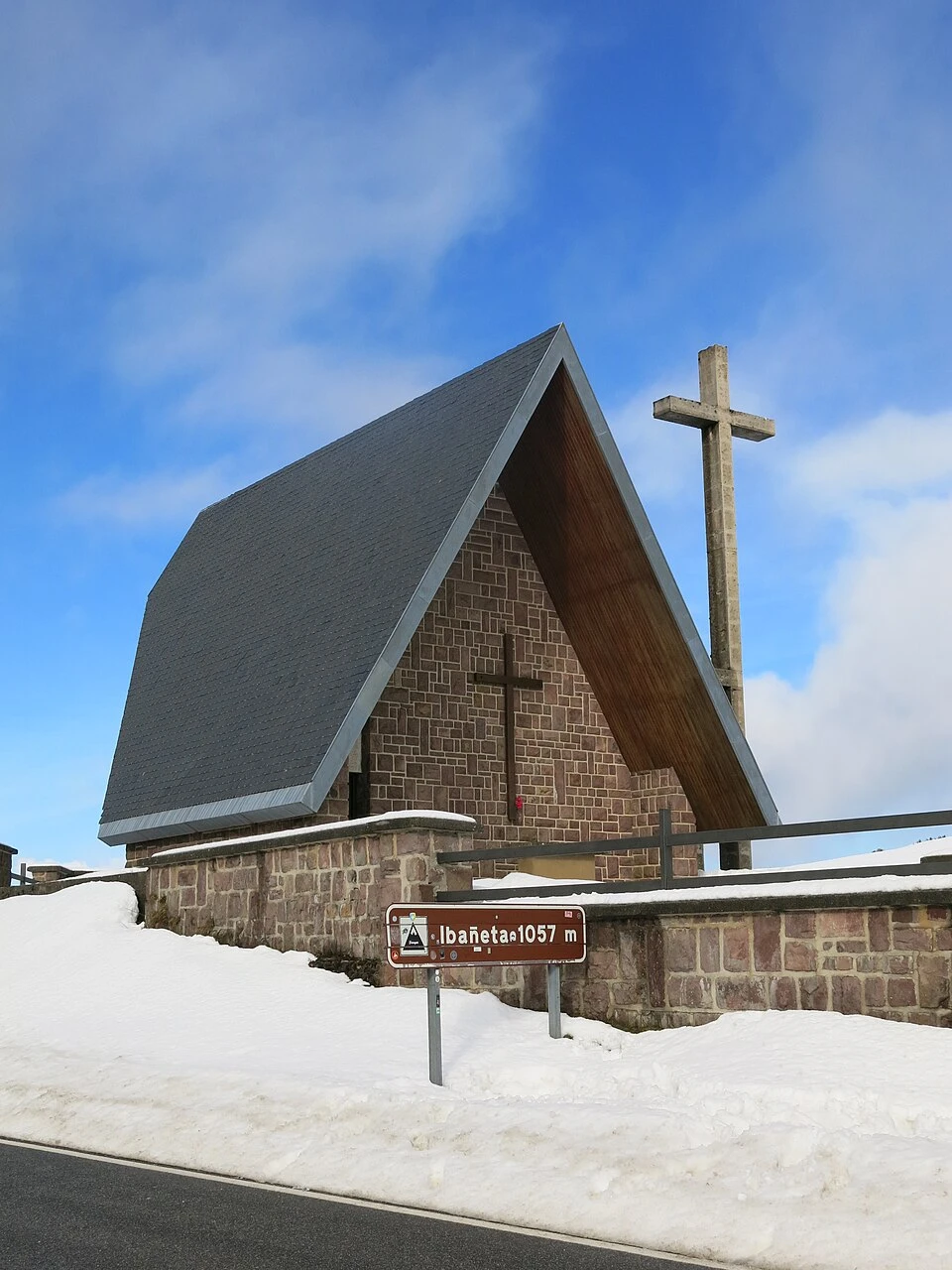
From Lepoeder there are two options for descending. There is a more direct descent, but in conditions of poor visibility or with wet terrain it is less advisable. The safer option passes through Ibañeta, where the Chapel of San Salvador is located, a place closely linked to the tradition of pilgrim assistance and the memory of the Pyrenean passage.

Final Section · Descent to Roncesvalles
The final descent completely changes the atmosphere of the day. After the spaciousness of the mountain comes a more intimate, damp, and forested landscape, where the beech forest accompanies the descent to Roncesvalles. It is a beautiful section, but also delicate for the joints, especially after the great accumulated effort in the climb. As the pilgrim loses altitude, arrival becomes almost a physical and emotional relief.
Km 24,2
· Roncesvalles
The arrival in Roncesvalles has something special about it. It is not just the end of a stage; for many it is the true emotional beginning of the French Way. The monumental ensemble that awaits the pilgrim reinforces that feeling: the Royal Collegiate Church of Santa María, the Church of Santiago, the Silo of Charlemagne, and all the historic surroundings make the arrival a destination laden with history, spirituality, and Jacobean memory.
During the route

What to See

Saint-Jean-Pied-de-Port and the Porte Saint-Jacques
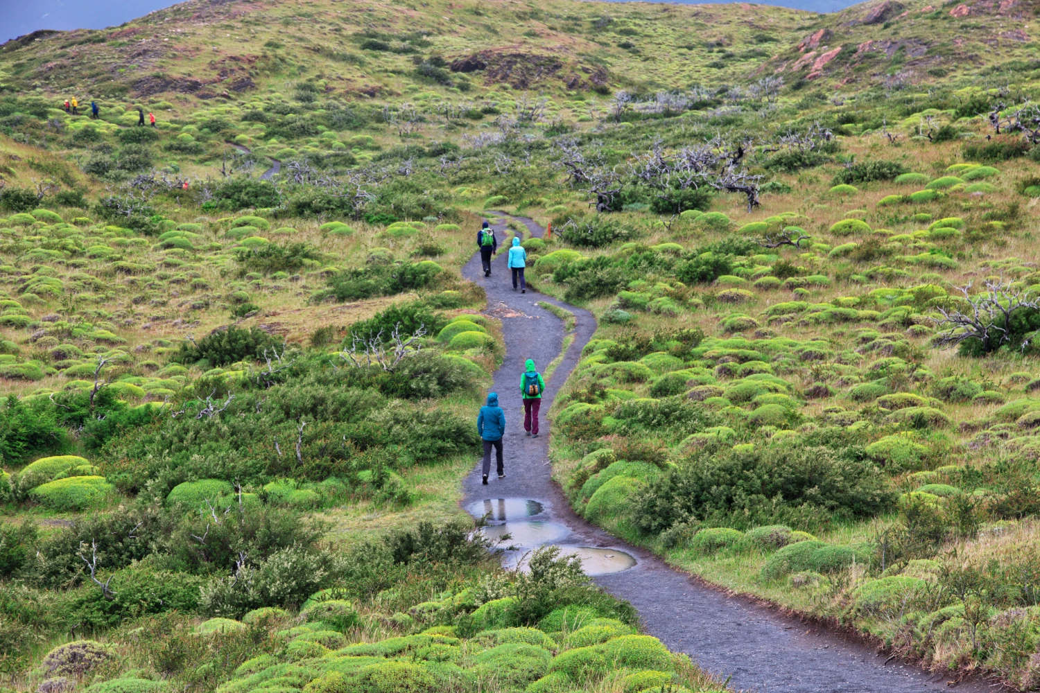
Before you even begin walking, it’s worth taking time for Saint-Jean-Pied-de-Port. Its fortified historic town center, the Rue de la Citadelle, the crossing over the Nive River, and the Porte Saint-Jacques form one of the most beautiful departures of the entire Way. The gate, moreover, is the historic entrance of pilgrims who crossed the town heading toward Roncesvalles and is recognized as part of the heritage of the Routes of Santiago.

Panoramas of the Puerto de Cize

The high section of the stage, especially between Honto, Orisson, and Lepoeder, offers some of the best mountain views of the entire French Way. On clear days, the pilgrim enjoys a landscape of high pastures, open hills, and Pyrenean horizons that justify by themselves the fame of this day.

Chapel of San Salvador de Ibañeta

In the surroundings of the Ibañeta pass lies the Chapel of San Salvador, one of the most symbolic places of this Pyrenean entrance. The location alludes to the ancient tradition of assisting pilgrims and the historic character of this corridor between the peninsula and Europe. Its value is not only monumental but also narrative: it is part of the imaginary of the Way in one of its most legendary sections.

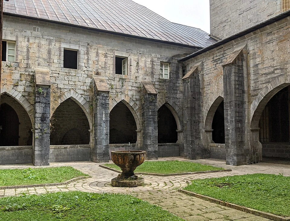
Royal Collegiate Church of Santa María de Roncesvalles
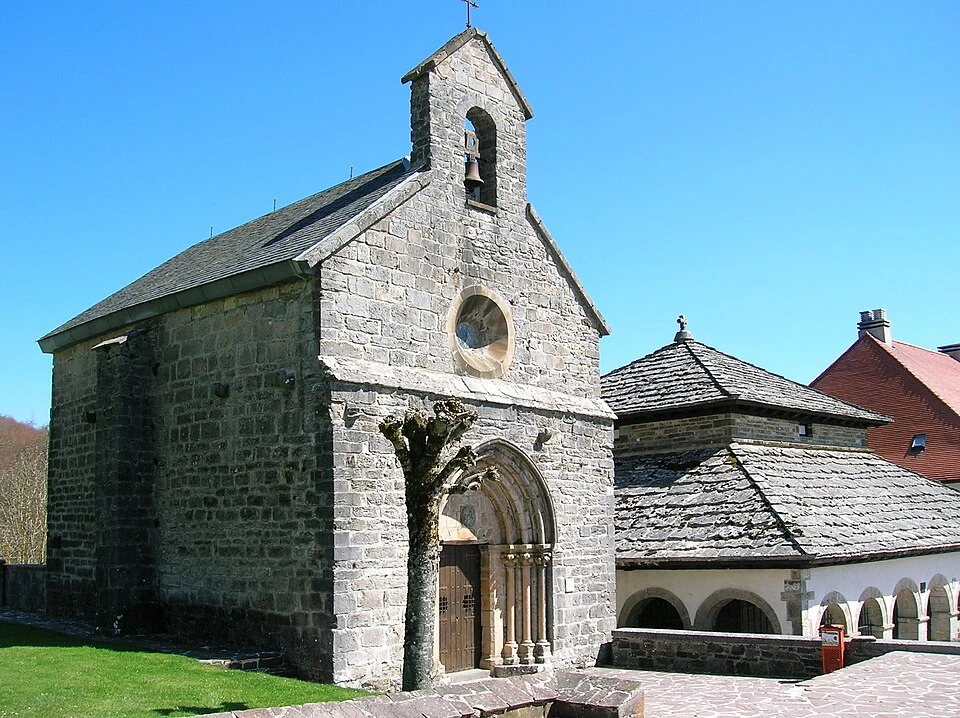
The collegiate church is the great patrimonial emblem of Roncesvalles. According to the official information of the monumental ensemble, the Church of Santa María is the first fully Gothic construction in Navarre, and for centuries has been one of the great spiritual centers of the area. Arriving there after crossing the Pyrenees makes the visit one of the most powerful moments of the stage.

Church of Santiago and Silo of Charlemagne

The Church of Santiago, a thirteenth-century Gothic chapel dedicated to the Apostle, underscores the importance of the Way in the origins of Roncesvalles. Very nearby is the Silo of Charlemagne, considered the oldest building in the ensemble and linked by legend to the Franks who died in the Battle of Roncesvalles; it was also a pilgrim cemetery for centuries.

Museum-Treasure of Roncesvalles

For those who wish to complete their cultural visit, the Museum-Treasure brings together artistic and historical pieces of great value related to the collegiate church and the history of Roncesvalles. Official information highlights sculptures, painting, metalwork, manuscripts, and other objects linked to Navarrese heritage and the tradition of this Jacobean enclave.
Towns of the stage

Localities

Saint-Jean-Pied-de-Port

Saint-Jean-Pied-de-Port is one of the most famous towns on the Way of Santiago in French territory. Located at the foot of the Pyrenean passes, it was a strategic stronghold and still today preserves charming architecture, with walls, bridges, medieval streets, and a marked pilgrim atmosphere. Its tourist office is located at 14 Place Charles de Gaulle, opposite the town hall, in the center of the town.

Honto

Small mountain hamlet in the first major climbing section of the stage. Its importance lies not so much in its size as in its function within the route: it is a physical and mental reference for the pilgrim, a point where the climb begins to become truly serious.

Orisson

Orisson is another landmark of this stage. Rather than a locality in the traditional sense, it functions as a strategic point of the ascent, known for its shelter and its views. It is one of the last clear places of support before entering the more open part of the Pyrenean crossing.

Roncesvalle

Roncesvalles is one of the most symbolic places on the French Way. For many pilgrims it is the true starting point of the Way in Spain, precisely because it avoids the complete crossing of the Pyrenees from Saint-Jean-Pied-de-Port. Despite its small size, it concentrates an exceptional monumental ensemble and a very intense Jacobean atmosphere. The official visit information places the tourist office in the Old Mill, and the collegiate ensemble continues to be today the great cultural and spiritual heart of the locality.

Route map

Ready to begin your journey?

Tell us what you’re looking for and we’ll design your tailor-made French Way, with a guide or self-guided.

Back

French way

Stage 2

Roncesvalles ❯ Zubiri

Request a quotation

Fill in the form and you will receive the quote in your email within 24-48 hours.

Contact Form