
Pamplona
❯ Puente la reina
23.5km
STAGE DISTANCE
Information
The stage between Pamplona and Puente la Reina is one of the best-known and most symbolic of the French Way in Navarre. It has an approximate distance of 23.9 km, an average duration of 5 hours and 45 minutes, and a profile more demanding than it appears at first glance: the climb toward the Sierra del Perdón is progressive, but the final section becomes harder, and the subsequent descent toward Uterga is stony and more uncomfortable than the ascent. Gronze summarizes the personality of the day very well: the mountain range completely marks the stage, with the wind farm on the ridge as a constant reference and a descent that demands attention.
The day also represents a clear change in landscape compared to the previous stage. You leave behind the Arga River surroundings and the urban entrance to Pamplona to walk among cereal fields, open hills, and villages of Valdizarbe. Turismo de Navarra describes this section as a departure from Pamplona that crosses the Acella bridge over the Sadar River, passes through Cizur Menor, and heads along agricultural tracks toward the Sierra del Perdón, with vast open spaces and views very different from those of the Esteribar Valley.
Furthermore, this is a stage with a special Jacobean charge because in its final section you enter the area where the routes coming from Roncesvalles and Somport converge. Consumer places that meeting in Obanos, while the tourist information for Puente la Reina recalls that, before entering the town, there is the crossing with the road along which the path from Somport arrives. For that reason, beyond the exact meeting point, this day clearly represents the moment when both great Pyrenean accesses of the Way approach each other until they become one.
Recommendation from The Way
Recommendation in stage 4: Pamplona – Puente la Reina
It is an accessible stage for a pilgrim in normal physical condition, but you should pace yourself. The climb to Perdón is not brutal, although it becomes long if heat or wind picks up, and the descent is the most delicate section of the day due to loose stone and irregular terrain. On windy days, the high area of the mountain becomes especially exposed, so it is worth being extra cautious at the summit.
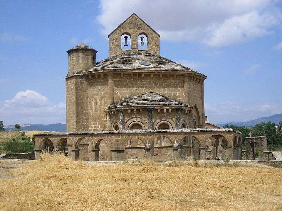
If you are interested in visiting Santa María de Eunate, keep in mind that the detour adds more than 3 km to the day. Consumer considers it a very recommendable visit and notes that it is well signaled; Turismo de Navarra insists that from Muruzábal you must decide between continuing straight toward Obanos or detouring to the temple. On a commercial or informative stage page, this detail should be made very clear so the pilgrim can assess whether it is worth the time and energy.
For cyclists and people with reduced mobility, the problematic point remains the descent from Perdón. It is not the friendliest part of the stage, so it is prudent to consider safer alternatives if ground conditions do not cooperate. On foot, outside that section, the day is comfortable and quite rewarding.
Stage profile
Itinerary
If you take the historic center as the starting point, the stage begins in the heart of Pamplona, around Plaza Consistorial and the streets of the old town. Turismo de Navarra describes the urban route with considerable precision: from the surroundings of the Magdalena Bridge and the Portal of France, the Way crosses streets such as Carmen, Navarrería, Mercaderes, Plaza del Ayuntamiento, San Saturnino, and Calle Mayor, before heading toward the area of Recoletas, Bosquecillo, Pío XII, Vuelta del Castillo, and the university campus. There, the Acella bridge crosses the course of the Sadar River and marks the transition from the city to the pedestrian path that leads to Cizur Menor.
Pamplona is, moreover, a city with enormous Jacobean and cultural weight. The City Council presents it as a great city of the Way, and internationally it is still associated with San Fermín, whose official information is centralized on the city council’s website. In terms of travel experience, it is a very good city to stay overnight, visit heritage sites, and depart the next day with all services at hand.
Police, medical attention, what to see, where to eat…
The route passes through Cizur Menor and progressively abandons the urban fabric to enter a more open landscape. Consumer points out here the Church of San Miguel, a good example of Romanesque, historically linked to a Saint John complex and restored in the late twentieth century. From this point onward, the Way advances along tracks between cereal fields and begins to outline the great climb of the day.
This section is important because it marks the definitive transition between city and countryside. Turismo de Navarra situates it between local road, dirt tracks, and edges of urbanization, until the route opens completely toward the Pamplona Basin and already shows the Sierra del Perdón in the distance.
Alto del Perdón is the culminating moment of the stage and one of the most recognizable places of the entire French Way. On the ridge, next to the wind turbines, stands the famous monument to the pilgrim, and the ensemble functions as one of the best viewpoints of the route. Gronze highlights that from there you can see Pamplona and the Pyrenees behind you, and toward the front the extensive Navarrese plain. That dual panorama explains why this peak has become one of the great icons of the Way.
The classic photo here is almost inevitable, but it is important not to forget that the descent begins immediately after and completely changes the tone of the stage. What until the summit was a sustained but reasonable climb becomes a rougher descent, with stone and unstable terrain.
Once down, the Way enters Uterga, now inside the Valdizarbe Valley. Consumer highlights here the Church of the Assumption, Gothic, surrounded by olive trees and with a columned atrium. Uterga very well represents the change in atmosphere after the mountain range: the landscape softens, villages reappear more frequently, and the Way recovers a less tense rhythm than that of the descent.
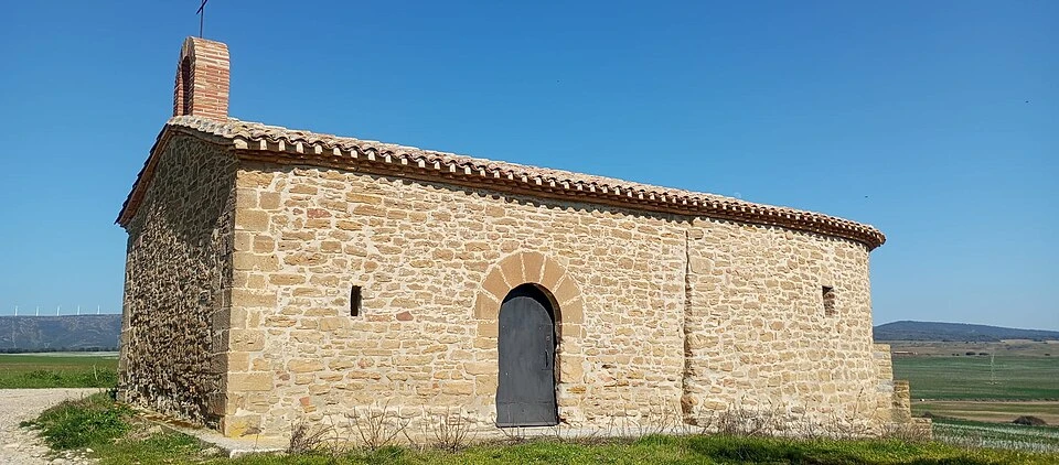
The next important village is Muruzábal, located on the south slope of Perdón. Turismo de Navarra highlights two clear references: the Church of San Esteban and the palace of the Marquis of Zabalegui, from the late eighteenth century, with a Baroque facade, corner towers, and an interior courtyard. Here appears, moreover, the great cultural decision of the day: continue straight toward Obanos or detour toward Eunate.
Muruzábal is one of those villages that greatly enriches the stage from a heritage perspective. It is not a huge stop, but quite useful for explaining that the Way not only links villages, but passes through ancient noble, agricultural, and religious areas with a very marked identity.
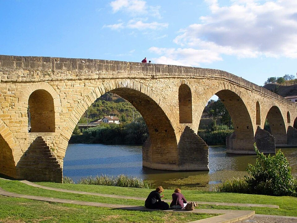
The stage ends in Puente la Reina/Gares, one of the most Jacobean towns of the entire French Way. The City Council explains that much of its architectural treasures can be seen simply by following the Way’s route through Crucifijo and Mayor streets. Among the most outstanding elements are the Church of the Crucifix, the Church of Santiago, Plaza Julián Mena, the nativity scenes, and, of course, the Romanesque bridge.
The arrival here has great force because the town clearly preserves its structure as a village-road. The pilgrim enters from the east, crosses the historic axis, and ends facing the absolute icon of the locality: the medieval bridge over the Arga.
Local information · Puente la Reina
Police, medical attention, what to see, where to eat…
What to See
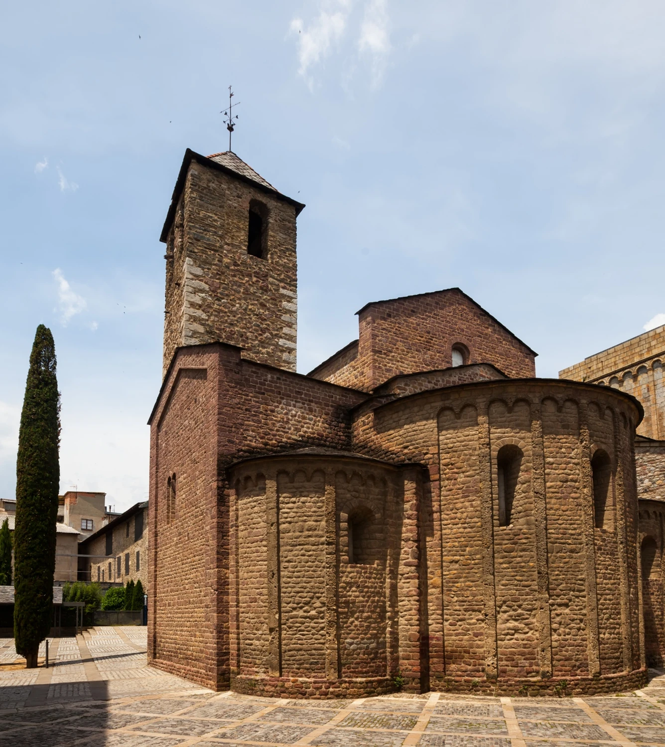
Church of San Miguel, in Cizur Menor
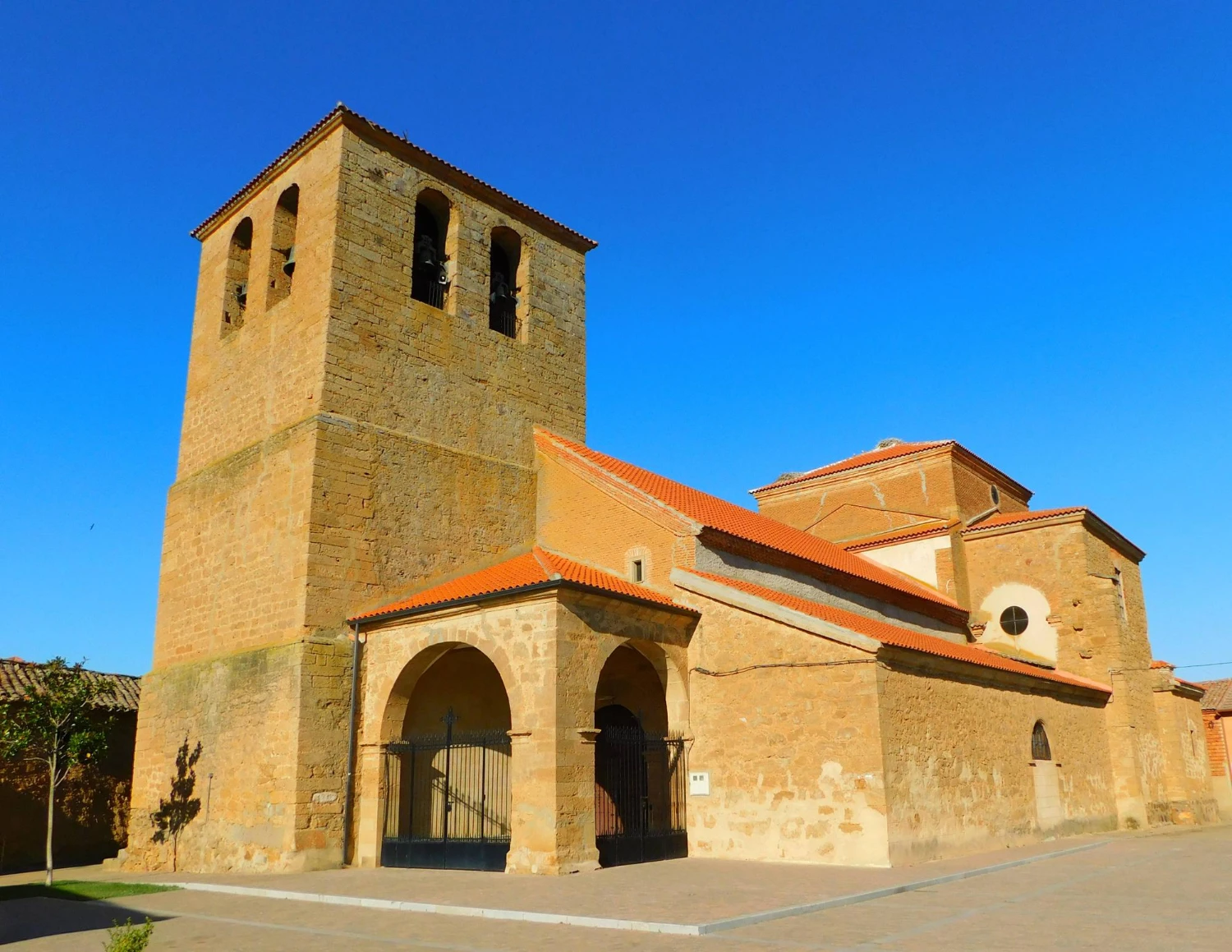
Church of San Andrés, in Zariquiegui
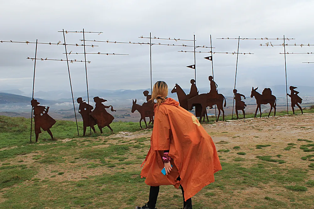
Alto del Perdón and Monument to the Pilgrim
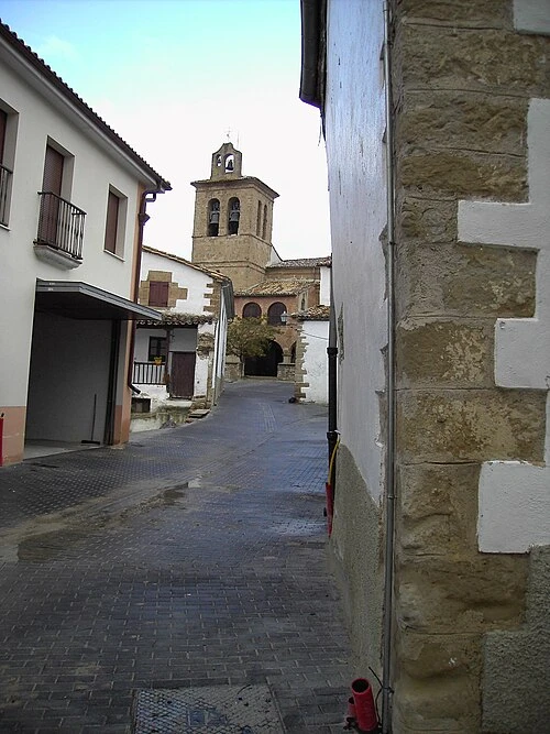
Church of the Assumption, in Uterga
Church of San Esteban and Palace of Muruzábal
Church of Santa María de Eunate
Romanesque Bridge of Puente la Reina
Localities
Pamplona
Puente la Reina / Gares
Route map
Ready to begin your journey?